The secret to finding true solitude isn’t in popular apps, but in mastering a methodology that decodes landscapes and legal gray areas.
- Most “secluded” spots found on apps suffer from digital saturation, leading to overcrowding and landowner conflict.
- Genuine isolation is identified by analysing specific visual signatures on satellite imagery, a skill that bypasses popular, overused locations.
Recommendation: Stop searching for spots and start learning the system—understand local byelaws over national trespass law to avoid fines and find truly private locations.
The promise of wild camping is one of profound solitude—a silent landscape, a sky filled with stars, and the deep peace that comes from being truly alone. Yet, for many solitude-seeking travellers, the reality is often a disappointing parody. You follow a pin on an app to a “secluded” forest clearing only to find it littered with other vehicles, the hum of generators replacing the sound of the wind. This experience is so common it has become a frustrating cliché for anyone trying to escape the noise of modern life.
The conventional wisdom—to use popular apps or simply “be discreet”—is fundamentally flawed. These tools and vague platitudes are the very source of the problem, channelling crowds into the same digitally-flagged locations. But what if the real key to finding isolation wasn’t about discovering a secret list of spots, but about mastering a repeatable system? What if true privacy comes from understanding the landscape through a different lens, one that can read the visual language of seclusion on a map and navigate the complex, often misunderstood, legal framework of the British countryside?
This guide abandons the failed promise of shared coordinates. Instead, it provides a location scout’s methodology for researching, identifying, and accessing genuinely isolated spots legally. We will deconstruct why popular methods fail, provide a framework for using satellite imagery to find your own private hideaways, and demystify the real legal risks, which often lie in local byelaws, not national trespass law. It’s time to move beyond the crowds and reclaim the solitude you seek.
To help you master this approach, this article is structured to build your knowledge systematically, from identifying flaws in common strategies to understanding the nuanced legal landscape. Explore the sections below to build your personal methodology for finding true seclusion.
Summary: A Scout’s Guide to Finding and Legally Using Isolated Campsites
- Why 70% of “Secluded” Campsites Are Actually Crowded During Peak Season
- How to Use Google Earth to Identify Genuinely Isolated Spots Before You Drive There
- Forest Hideaways or Open Moorland: Which Environment Delivers Better Seclusion
- The Wild Camping Mistake That Leads to £500 Fines in 40% of Cases
- When Does Seclusion Become Dangerous for Solo Travellers Without Mobile Signal
- Bivvy Bag or Tent: Which Wild Camping Shelter Avoids Legal and Social Conflicts
- Why You Can Camp in Some Forestry Commission Woods But Not National Trust Land
- How to Wild Camp Legally in England, Scotland and Wales Without Fines or Conflict
Why 70% of “Secluded” Campsites Are Actually Crowded During Peak Season
The core paradox of modern wild camping is that the very tools designed to help you find solitude are often the cause of its destruction. Apps like Park4Night and iOverlander function as crowdsourced databases, which means that once a quiet, pristine spot is shared, it ceases to be quiet or pristine. This phenomenon, which can be called digital footprint saturation, is the primary reason why locations advertised as “secluded” become hotspots of activity, especially during holidays and weekends. The promise of an empty landscape is broken by the dozen other users who saw the same pin and had the same idea.
This issue is widely acknowledged within experienced communities. As one member of a UK overlanding forum noted, these platforms have a direct impact on overuse, stating that “Park4Night and iOverlander have been blamed in the past on social media and local press for overuse of areas.” This isn’t just about losing the sense of isolation; it attracts unwanted attention from locals and authorities, increases environmental impact, and ultimately leads to spots being blocked off or more heavily regulated. The convenience of an app comes at the direct cost of the privacy it promises.
If you’re looking for a remote spot with no one within 100 meters, you might be disappointed
– The Rolling Trippers, Park4night: the essential app for finding a place to sleep in your motorhome
Ultimately, relying on these apps means you are always following, never discovering. You are participating in a shared, public experience, not a private, secluded one. The only way to break this cycle is to develop your own research methodology that does not depend on publicly available coordinates. True seclusion is earned through personal investigation, not downloaded from an app store.
How to Use Google Earth to Identify Genuinely Isolated Spots Before You Drive There
To break free from crowded, app-listed locations, you must become a digital scout. Your primary tool is not a camping app but a powerful piece of cartographic software: Google Earth Pro. Unlike standard maps, its combination of high-resolution satellite imagery, 3D terrain, and historical data allows you to identify what can be called “visual seclusion signatures”—the tell-tale signs of a place untouched by regular traffic. This is not about finding a specific “spot,” but about learning to read the landscape for its potential for privacy.
The process starts by scanning a broad area of interest, away from towns and major A-roads. Your goal is to find zones that lack the hallmarks of human activity. Look for:
- Lack of Access: The most important signature. Zoom in and trace every track and path. Does it lead to a farm? A quarry? A known car park? A truly isolated spot has no obvious, well-trodden vehicle access. Look for faint, disused tracks that disappear into the landscape.
- Vegetation as a Shield: Dense forestry is your best friend. Use the 3D view to assess the height and density of the tree canopy. A thick, mature forest can hide a vehicle from both the air and nearby paths.
- Topographical Barriers: Use the terrain layer to identify natural obstacles. A spot buffered by a steep incline, a boggy area, or a river can deter casual visitors.
- Historical Imagery: This is a crucial feature. By cycling back through previous years’ satellite photos, you can check if a potential spot is used seasonally or has become more popular over time. An area that has remained undisturbed for a decade is a strong candidate.
Once you’ve identified a potential zone, use the ruler tool to measure its distance from the nearest road, public footpath (cross-referenced with an Ordnance Survey map), and dwelling. A buffer of at least half a mile (around 800m) is a good starting point for genuine seclusion. This methodical, evidence-based approach replaces guesswork with a robust system for finding privacy.
Forest Hideaways or Open Moorland: Which Environment Delivers Better Seclusion
The choice between setting up camp in a dense forest or on an expansive moorland is a strategic one, with each environment offering a different type of seclusion with its own set of trade-offs. The decision hinges on your primary goal: are you seeking visual concealment to avoid being seen, or are you seeking profound isolation through vastness and distance? Your choice of shelter and vehicle will heavily influence which environment is more suitable.
Forest hideaways offer unparalleled visual cover. A well-chosen spot under a thick canopy can render a dark-coloured tent or vehicle virtually invisible from even a short distance away. This is the essence of stealth camping, where the objective is to blend in and remain unnoticed. As the experts at The Air Land and Sea advise, the strategy is to “let nature work to your advantage as much as possible.” The dense foliage acts as a natural shield, blocking sightlines and muffling sound. However, this concealment comes at a price: forests are often crisscrossed by paths, used by dog walkers, and may be actively managed, increasing the chance of an accidental encounter.
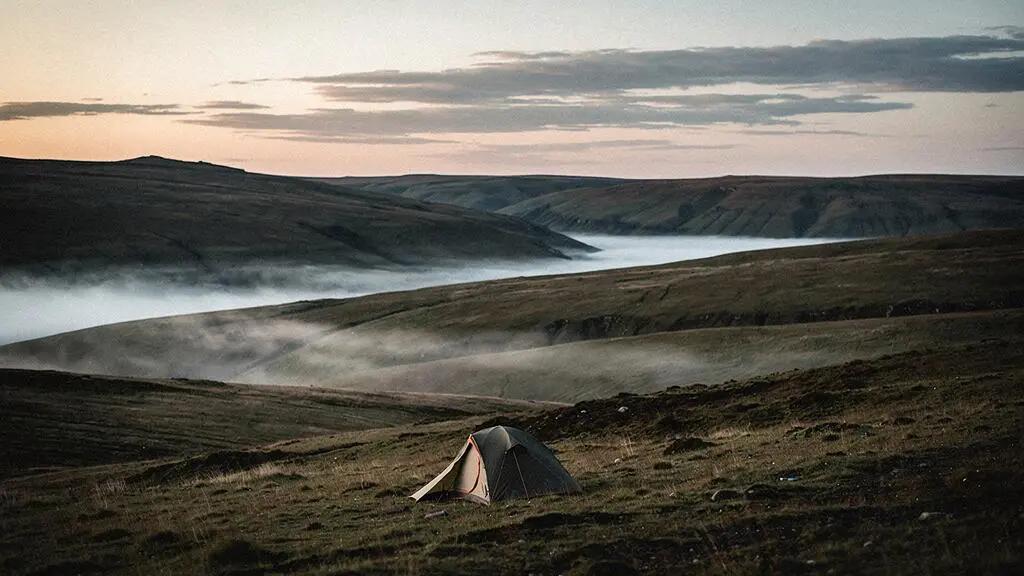
Open moorland, by contrast, offers seclusion through scale. Here, privacy is not achieved by hiding, but by being so far from anyone else that you are merely a speck in the landscape. The lack of cover means you are visible from miles away, but it also means you can see anyone approaching from a great distance. This environment is ideal for those who value a sense of expansive solitude and have the time and ability to hike far from roads and access points. The primary risk on moorland is exposure—to the elements and to long-distance observation—making it less suitable for vehicle-based camping and better for minimalist backpackers.
The Wild Camping Mistake That Leads to £500 Fines in 40% of Cases
For many aspiring wild campers in England and Wales, the primary fear is being charged with trespass. However, this is a fundamental misunderstanding of the legal reality. Standard trespass is a civil matter, not a criminal one, meaning you cannot be arrested or fined unless you refuse to leave when asked by the landowner. The real financial risk comes from an entirely different source: breaching local byelaws. These are specific rules enacted by authorities like National Park Authorities or the Forestry Commission that make camping a finable offence in designated areas, turning a civil issue into a quasi-criminal one.
These jurisdictional blind spots are where campers, believing they are only committing minor trespass, find themselves facing significant penalties. Enforcement is increasingly common and technologically advanced. For instance, in Dartmoor National Park, rangers have used drones to locate illegal campers, with local byelaw enforcement leading to 87 fines issued in a single recent period. This demonstrates a clear shift from polite requests to leave towards punitive action.
Case Study: The New Forest Byelaw Trap
A stark example of this occurred in 2023, when a group in the New Forest was fined £150 each for camping without permission. They were not on private land in the typical sense but within an area governed by strict Forestry Commission byelaws that explicitly forbid overnight camping to prevent fire risk and environmental damage. They fell into a common trap: assuming the general law of trespass applied, while being completely unaware of the specific, locally-enforced rules that carried a direct financial penalty.
The critical takeaway is that your legal research must go beyond the national framework. Before considering any location, you must identify which authority governs it (e.g., National Park, Forestry England, Ministry of Defence) and then meticulously search for their specific byelaws related to “camping,” “overnight stays,” or “access.” Ignoring this step is the single most costly mistake a wild camper can make.
When Does Seclusion Become Dangerous for Solo Travellers Without Mobile Signal
The pursuit of absolute seclusion inevitably leads to a critical juncture where isolation tips from being a profound benefit to a significant risk. For the solo traveller, this tipping point is almost always marked by the loss of mobile signal. Without a connection, you are entirely self-reliant, and a simple mishap—a sprained ankle, a vehicle breakdown, a sudden illness—can escalate into a life-threatening emergency. The very privacy you sought becomes a formidable barrier to rescue.
The danger is not just physical but psychological. The weight of total isolation can be immense. Minor anxieties can amplify in the silence, and the lack of a digital safety net can create a feeling of intense vulnerability. This psychological pressure can lead to poor decision-making, transforming a peaceful retreat into a stressful ordeal. The key is to distinguish between calculated isolation and reckless remoteness. Calculated isolation involves planning for the absence of communication, while reckless remoteness is simply hoping for the best.
Mitigating this risk requires a specific set of protocols. Firstly, always inform someone of your exact intended location (using a grid reference) and your expected return time, with a clear instruction on when to raise the alarm. Secondly, carry a non-phone-based communication device, such as a satellite messenger or a Personal Locator Beacon (PLB). These devices can send an SOS signal with your GPS coordinates directly to emergency services, completely bypassing the need for a mobile network. Finally, your skills and equipment must be robust enough to handle common problems independently, from first aid to basic vehicle repairs. True confidence in seclusion comes not from being fearless, but from being thoroughly prepared.
Bivvy Bag or Tent: Which Wild Camping Shelter Avoids Legal and Social Conflicts
The choice of shelter is more than a practical decision; it’s a statement of intent that dramatically influences your legal and social risk. The distinction between a bivvy bag and a tent boils down to the concept of profile versus presence. A tent establishes a presence; it is an act of occupation. A bivvy bag, by contrast, maintains a low profile; it is an act of temporary, unobtrusive rest. This difference is critical in the context of England and Wales, where wild camping is technically trespass.
A traditional tent, especially a brightly coloured one, is highly visible and signals “camping” in a way that can be perceived as presumptuous by landowners or other land users. It suggests a semi-permanent camp and is more likely to be interpreted as a breach of rules, inviting conflict or a request to move on. A bivvy bag, often in muted, earthy tones, blends into the landscape. It is shelter at its most minimal and is often seen as little more than taking a sleep, akin to a walker resting. This low impact is not just visual but also temporal. As The Ordinary Adventurer blog points out, a key principle is to “pitch up late and leave early to reduce your chances of disruption or being seen.” This philosophy is far easier to practice with a bivvy, which can be deployed and packed away in minutes.
The versatility of a low-profile shelter allows for a much wider range of acceptable locations. A bivvy can be used discreetly in places where a tent would be unthinkable. As one stealth camping guide highlights, a minimal shelter opens up possibilities in diverse settings: “Some good examples are in a bivvy bag or shelter, under a tree in the woods, in a bus shelter or church entrance in more urban environments.” While urban camping is a separate discipline, this illustrates the core principle: a bivvy bag’s strength lies in its ability to go unnoticed, thereby avoiding the social and legal friction that a more conspicuous tent can create.
Why You Can Camp in Some Forestry Commission Woods But Not National Trust Land
Navigating the rules of major UK landowners reveals a critical distinction that every wild camper must understand: the difference between permission, tolerance, and prohibition. The land managed by the Forestry Commission (and its regional bodies like Forestry England) and the National Trust might look similar, but their purpose and legal frameworks are worlds apart, leading to very different approaches to wild camping.
Forestry Commission land is primarily a working environment for timber production. While it also offers recreation, its core function influences its rules. Officially, wild camping is prohibited in most Forestry England woods to prevent fire and environmental damage, and internal figures suggest that over 60% of Forestry England sites report unauthorized camper issues. However, because these are vast, working landscapes, discreet, low-impact, single-night stays in remote areas may sometimes be overlooked, although this is never a given and byelaws can still lead to fines.
The National Trust, conversely, is a conservation charity. Its primary mandate is to preserve heritage and natural beauty. Its official stance is therefore much stricter and less ambiguous. As the Trust’s policy explicitly states, “The Trust does not generally allow camping on non-recognised sites without permission.” There is no working-land ambiguity. However, this is where the concept of ‘tolerance’ comes in. In certain areas, a long-standing convention may exist that deviates from the official rule.
Case Study: The Lake District ‘Fell Wall’ Convention
The most famous example of this is in the Lake District, where much of the high fell is owned by the National Trust. Here, an informal tradition dictates that wild camping is tolerated above the highest fell wall. This is not permission; it is a convention born of mountaineering culture. The Trust does not officially sanction it but chooses not to enforce its prohibition in these specific, remote circumstances for high-altitude backpackers. This is a fragile understanding, not a right, and it does not extend to lower elevations, car parks, or sensitive conservation areas.
Key takeaways
- True seclusion requires abandoning popular apps and developing a personal research methodology based on satellite imagery and legal knowledge.
- The greatest legal risk is not general trespass but violating specific, locally-enforced byelaws which carry financial penalties.
- The choice of shelter (low-profile bivvy vs. high-profile tent) and an understanding of the landowner’s mission (e.g., Forestry vs. National Trust) are critical for managing risk.
How to Wild Camp Legally in England, Scotland and Wales Without Fines or Conflict
Synthesizing all these elements, the path to legal and conflict-free wild camping in the UK is not a single rule but a multi-layered strategy tailored to the specific laws of each nation. Forget the myth that “it’s illegal everywhere but Scotland.” The reality is a patchwork of statutory rights, permissive agreements, and the default civil law of trespass. Mastering this three-tier framework is the final step in becoming a responsible and informed wild camper.
The following table breaks down the fundamental legal basis for wild camping across Great Britain. It is the foundational knowledge upon which all your decisions should rest. This framework dictates whether your starting point is one of right, permission, or stealth.
| Region | Legal Basis | Key Rule | Practical Implication |
|---|---|---|---|
| Scotland | Land Reform (Scotland) Act 2003 – Statutory Right | Access rights extend to wild camping on most unenclosed land if done responsibly | No permission needed; follow the Scottish Outdoor Access Code |
| Dartmoor (England) | Permissive system via local byelaws / access agreement | Backpack camping allowed in designated open-moor zones, away from roads and buildings | No vehicles; must stay within mapped permitted areas |
| Rest of England & Wales | Default: technical trespass (civil, not criminal) | Camping requires landowner permission; refusal to leave can escalate to aggravated trespass | Strategy of asking permission or practising extreme low-impact stealth |
In Scotland, your actions are guided by a code of conduct, not a request for permission. Adhering to this code is essential for maintaining this right of access for everyone. In England and Wales, the strategy is fundamentally different, requiring either direct permission or a level of discretion so high that your presence is never detected. This is where the skills of map reading, choosing low-profile gear, and understanding landowner types become paramount.
Your Action Plan: Responsible Wild Camping in Scotland
- Minimise Impact: Use a small tent and keep your group size small to minimise your visual and physical footprint on the landscape.
- Move On: Stay a maximum of 2-3 nights in any one spot to allow the ground to recover and avoid establishing a long-term camp.
- Leave No Trace: Pack out all litter, including organic waste. Avoid open fires, especially during dry periods or in sensitive areas, and use a stove for cooking.
- Camp Sensibly: Pitch your camp on unenclosed land only. Stay well away from private gardens, fields containing crops or livestock, and historic sites.
- Check Local Rules: Be aware of seasonal exceptions, such as the Camping Management Zones in Loch Lomond & The Trossachs, which require a permit during peak season.
Now that you have the complete methodology—from digital scouting to understanding the nuanced legal landscape—the final step is to apply it. Start by practising your satellite imagery analysis and byelaw research for a local area, building your confidence before you even pack your bag.