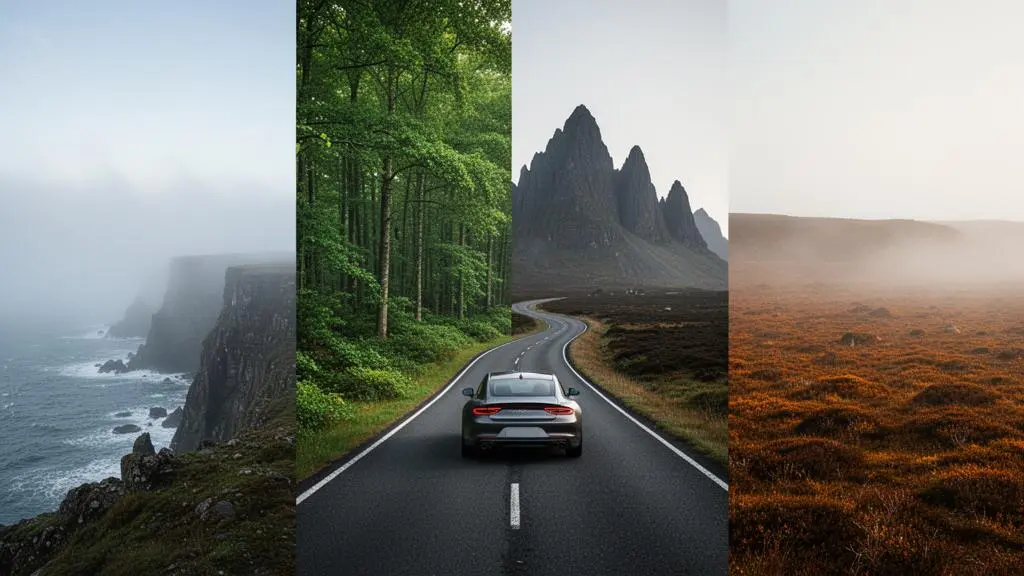
The biggest road trip planning failure is not poor destinations, but poor sequencing, leading to scenic monotony and burnout.
- Effective routes are built like a narrative, strategically alternating contrasting terrains (coast, forest, mountain) to maximise psychological impact.
- Relying on default 2D road maps is a critical error; using topographic layers is essential to validate that your route delivers true landscape diversity.
Recommendation: Shift your focus from simply connecting points A and B to optimising the ‘experiential density’ of your route, ensuring every mile driven offers a meaningful shift in scenery.
The classic image of a road trip—endless open road, a singular landscape stretching to the horizon—is compelling for about two days. By day three, that majestic coastline or sprawling mountain range can become a monotonous green and blue blur. Many adventure drivers, aiming to maximise their experience, fall into this trap: they plan routes dedicated to a single type of scenery, believing more of a good thing is better. This approach often leads to “scenic fatigue,” where the initial awe fades into a mild sense of obligation to keep driving.
The common advice to “just pick spots you like” or “use Google Maps” overlooks the core of brilliant route design. It’s not about the destinations themselves, but about the flow and contrast between them. The real art of planning an impactful journey lies in treating the route itself as the primary experience. This requires a shift in mindset from a tourist’s checklist to a geographer’s strategy, considering elements like topographical variance, narrative pacing, and even the cognitive load of too many stops.
But what if the key wasn’t to cover more ground, but to make the ground you cover more diverse? The fundamental principle is this: you can experience more scenic variety in a 400-mile loop than many do in a 2,000-mile linear slog. This is achieved by strategically sequencing landscapes and using advanced mapping tools to validate your route’s true character before you ever turn the key. It’s about designing for efficiency of experience, not just distance.
This guide will deconstruct the expert process for building such a trip. We will explore the science behind scenic burnout, the methodology for sequencing terrain for optimal flow, the critical mapping mistake to avoid, and the precise daily distances that allow for immersion without exhaustion. By the end, you will have a strategic framework to design compact, high-impact road trips that feel vast and varied.
Summary: Crafting a Multi-Landscape Driving Narrative
- Why Coastal-Only or Mountain-Only Routes Lead to Scenery Fatigue After 3 Days
- How to Sequence Coastal, Forest, Mountain and Moorland Segments for Optimal Flow
- Circular Multi-Terrain Loops or Linear Routes: Which Maximises Landscape Diversity
- The Mapping Mistake That Cancels Geographical Diversity in 60% of Planned Routes
- What Daily Distance Allows You to Experience 3 Terrain Types Without Burnout
- Why Visiting 5 Places Per Day Blocks the Reflective Brain States That Reduce Stress
- Why a 2.4m Wheelbase Turns in 4m Less Space Than a 2.8m Wheelbase Vehicle
- How to Plan a 3-Week Road Expedition Without Burnout or Budget Blowouts
Why Coastal-Only or Mountain-Only Routes Lead to Scenery Fatigue After 3 Days
The initial thrill of a dramatic landscape—the crash of waves on a rugged coast or the endless vistas from a mountain pass—is a powerful experience. However, the human brain is an efficiency machine, wired to filter out repeating stimuli. This psychological principle is known as habituation. When exposed to the same type of input repeatedly, our neurological response diminishes. What was once novel and exciting becomes the background, losing its impact. This is the root cause of “scenic burnout” on a monotonous road trip.
After two or three days of driving through functionally similar terrain, even if it’s beautiful, the brain begins to generalise the experience. The tenth stunning coastal overlook feels less impactful than the first; the fifth winding mountain road is less thrilling than the one before. As the iMotions research team notes in their analysis of the phenomenon, the mechanism is about cognitive conservation.
The implication is clear: without novelty, impact fades.
– iMotions Research Team, What is Habituation, and How Does it Work? — iMotions Blog
To combat this, a route must be designed with deliberate scenic contrast. The goal is to “reset” the brain’s novelty detector. By transitioning from a coastline to a dense forest, and then ascending into rugged mountains, you are feeding the brain a sequence of distinct environmental data. Each shift acts as a new stimulus, preventing habituation and keeping the sense of discovery alive. A single-terrain route, therefore, is not an immersion but a fast track to sensory indifference, undermining the very purpose of an adventure-focused drive.
The strategic error is committing an entire itinerary to one “anchor” landscape instead of using it as one of several alternating acts in your journey’s narrative.
How to Sequence Coastal, Forest, Mountain and Moorland Segments for Optimal Flow
An effective multi-terrain road trip is not a random collection of landscapes; it is a carefully constructed narrative. The sequence in which you experience different terrains dictates the emotional arc of the journey. The most successful routes often follow a classic storytelling structure: they start with something open and calming, build towards a dramatic climax, and then resolve into a gentle conclusion. This approach to terrain sequencing transforms a simple drive into a memorable experience.
Consider this strategic sequence for a day’s drive:
- The Opening (Coast): Start the day along a coastline. The wide horizons, rhythmic sounds, and gentle curves establish a sense of freedom and calm. This is your story’s exposition.
- The Transition (Forest): Move inland into a dense forest. The environment becomes more enclosed, the light more dappled. This change in scale and texture builds anticipation and feels like a journey into a different world.
- The Climax (Mountains): The route then begins to climb into the mountains. The roads become tighter, the views more dramatic and challenging. This is the peak of the narrative arc, delivering the highest-intensity scenic reward.
- The Resolution (Moorland/Farmland): Descend from the mountains into rolling moorland or open farmland. The landscape softens, providing a sense of release and a place for reflection after the intensity of the peaks.
This structure ensures that each landscape’s unique character is amplified by the one that preceded it. The mountains feel more dramatic after the enclosure of the forest; the open moors feel more peaceful after the concentration required for mountain driving.
As the visual metaphor above suggests, each element builds upon the last to create a satisfying whole. Reversing the order can be just as effective, such as moving from dramatic mountains to a calming coastline. The key is not a rigid formula, but the conscious application of contrast. Avoid placing two functionally similar landscapes back-to-back (e.g., a pine forest followed by a deciduous forest) and instead focus on maximising the shift in scale, colour, and texture with each segment of your drive.
Ultimately, flexibility is crucial. If a particular zone is especially captivating, it’s better to allow for extra time there than to rigidly force a transition just to stick to a pre-planned schedule.
Circular Multi-Terrain Loops or Linear Routes: Which Maximises Landscape Diversity
When designing a route for maximum scenic diversity, the choice between a linear (one-way) path and a circular loop is a primary strategic decision. While linear routes are classic for cross-country epics, for compact, high-variety trips under 400 miles, the circular or “lollipop” loop often offers superior efficiency and diversity. A linear route, by definition, requires you to continuously move into new territory, which can spread scenic highlights too thinly over long distances.
In contrast, a loop route allows you to explore a geographically concentrated area of high diversity from multiple angles without inefficient backtracking. Many regions, especially those containing national parks or protected areas, feature a confluence of different ecosystems in close proximity. For example, in the United States, with over 63 national parks across the country, many of these parks offer compact, high-diversity zones ideal for loop routing. You can drive into a park, complete a scenic loop that touches mountains, forests, and valleys, and exit a different way.
The most effective hybrid model is the “lollipop loop.” This involves a linear “stick” to get you from your starting point to the high-diversity zone, followed by a circular “candy” portion that explores the area intensively. This structure maximises your time in the most interesting terrain while minimising time spent on potentially monotonous access roads.
As illustrated, the lollipop structure is purpose-built for scenic efficiency. Linear routes excel when the goal is to cover vast distances and see broad regional changes. However, for a trip focused on experiencing four different landscapes in under 400 miles, the loop’s ability to pivot and re-engage with a compact, varied area makes it the strategically superior choice. It allows you to feel like you’ve had a grand journey without the logistical complexity or fuel costs of a long one-way trip.
The final decision depends on the specific geography of your target region, but for maximising diversity within a tight mileage budget, the loop is almost always the more potent design.
The Mapping Mistake That Cancels Geographical Diversity in 60% of Planned Routes
The single most common and critical error in planning a multi-terrain road trip is relying solely on default 2D road maps like those on standard Google or Apple Maps. These tools are designed for navigational efficiency—finding the fastest or shortest path between two points—not for experiential quality. They show you the road, but they tell you almost nothing about the character of the landscape the road passes through. A line on a flat map might traverse a breathtaking mountain pass or a featureless agricultural plain; the map treats both as equal.
This is the mistake that nullifies even the best-laid plans. You might pick four theoretically diverse points, but the navigation algorithm, optimising for speed, will likely keep you on major highways that bypass the very terrain you intended to see. The solution is topographical validation. This involves using advanced mapping platforms and layering systems to see the landscape’s three-dimensional reality before you drive. While default maps are 2D, advanced platforms like Gaia GPS offer access to over 251 different mapping layers, providing a vastly richer view of the terrain.
By adding layers like “Shaded Relief” or “Slope Angle Shading,” you can instantly see where the mountains rise, where the valleys open up, and where the land is flat and uninteresting. This allows you to manually adjust your route, dragging it off the highway and onto the smaller backroads that actually engage with the landscape. Tools like Gaia GPS and CalTopo are indispensable for this process.
The following table, based on an in-depth comparative analysis of GPS platforms, breaks down the strengths of two leading tools for this kind of deep planning.
| Feature | Gaia GPS | CalTopo |
|---|---|---|
| Shaded relief / terrain detail | Excellent, high-resolution infill in popular areas | Excellent, slightly preferred graphic appearance by some users |
| Best use case | Mobile, on-the-go route discovery and navigation | Deep desktop planning and custom map building |
| Data source | Pulls largely from OpenStreetMap plus proprietary layers | Pulls largely from OpenStreetMap plus USGS-based overlays |
Your Action Plan: How to Overlay Terrain Layers to Reveal the Real Landscape
- Open the map builder or layers menu on your mapping tool and add a topographic base layer instead of relying on the default flat road view.
- Turn on a slope-shading or relief overlay to see at a glance which sections of your route cross steep, dramatic terrain versus flat, monotonous stretches.
- Cross-check your planned route against the shaded layer before finalizing, adjusting waypoints so the drive actually passes through the terrain contrast you intended.
Without this step, your “multi-landscape” trip can easily become a tour of service stations and highways that just happen to be near interesting places.
What Daily Distance Allows You to Experience 3 Terrain Types Without Burnout
A common misconception in road trip planning is that covering more miles equals a better trip. In reality, for a journey focused on scenic diversity and immersion, excessive daily mileage is counterproductive. Pushing for 500+ miles a day leaves no time to get out of the car, feel the environment, and appreciate the textural shifts between landscapes. The goal is to find the optimal balance between making progress and allowing for meaningful immersion time. You don’t just want to see the forest; you want to have time to stop, walk among the trees, and breathe the air.
Research and expert consensus point to a clear sweet spot for daily driving. According to a landmark study by the University of Michigan Transportation Research Institute, 200-300 miles per day is the optimal distance for maximising road trip enjoyment while minimising fatigue. This range typically translates to 4-6 hours of actual driving, leaving a significant portion of the day for stops, short hikes, photography, or simply absorbing the atmosphere of each distinct terrain.
To plan a day that incorporates three different landscapes within this framework, you must budget your time, not just your miles. A solid rule of thumb is to cap total driving at a maximum of 9 hours and to take a substantial 45-minute break for every 4.5 hours behind the wheel. This structure allows you to allocate roughly 1-2 hours of driving for each terrain segment, with an additional 1-2 hours of “immersion” time spread across the day’s stops.
This macro view of a tire tread across different textures serves as a powerful symbol. The goal of the drive isn’t just to roll over the landscape, but to allow the landscape to make an impression on you. Driving 250 miles through three distinct zones with time to stop is a far richer experience than driving 500 miles through one. Exceeding the 300-mile threshold is a trade-off where you start sacrificing experience for the sake of mileage, leading directly to the burnout you’re trying to avoid.
By respecting this limit, you transform the drive from a logistical challenge into a sustainable and deeply rewarding exploration.
Why Visiting 5 Places Per Day Blocks the Reflective Brain States That Reduce Stress
In the quest for an “efficient” road trip, many planners fall into the “checklist trap”: trying to cram as many named stops as possible into a single day. The logic seems sound—more stops mean you’ve “seen” more. However, this approach is deeply counterproductive to the goal of stress reduction and genuine experience. Rushing between five or more points of interest a day creates a state of continuous cognitive load. Your brain is constantly engaged in the logistics of navigating, parking, orienting, and planning the next move, leaving no room for the deeper, reflective mental states that travel is meant to foster.
True immersion and the associated stress-reducing benefits occur when the brain can switch off its executive planning functions and enter a more passive, observant mode. This is often referred to as the “default mode network,” a brain state associated with reflection, daydreaming, and consolidating memories. When you are rushing from one photo op to the next, this network never gets a chance to engage. You are merely collecting data points (photos, check-ins) rather than forming rich, integrated memories.
Instead of a five-stop dash, a more effective strategy is the “one major, two minor” approach. For each day, plan one significant stop where you will spend a substantial amount of time (e.g., a two-hour hike in the mountains). Complement this with two smaller, more spontaneous stops (e.g., a 15-minute pause at a coastal viewpoint, a quick coffee in a forest village). This structure provides an anchor for the day’s experience while still allowing for flexibility and discovery. It respects the brain’s need for both engagement and downtime, ensuring that you end the day feeling refreshed and enriched, not just tired.
By prioritising depth of experience over breadth of stops, you allow the journey to have a lasting, restorative effect.
Why a 2.4m Wheelbase Turns in 4m Less Space Than a 2.8m Wheelbase Vehicle
While high-level route strategy is paramount, the practicalities of vehicle choice can make or break a multi-terrain trip. The most scenic and rewarding roads—the ones that truly engage with the landscape—are often narrow, winding, and tight. Your ability to comfortably and safely navigate these roads is directly tied to your vehicle’s dynamics, specifically its wheelbase and turning circle. This is not a trivial detail; it is a downstream consequence of choosing a route optimized for diversity over one optimized for highway speeds.
The wheelbase is the distance between the center of the front and rear wheels. A shorter wheelbase allows for a significantly tighter turning circle. For instance, a vehicle with a 2.4-meter wheelbase might have a turning circle of around 10 meters, whereas a vehicle with a 2.8-meter wheelbase could require 14 meters or more to make the same U-turn. That four-meter difference is the gap between easily navigating a tight mountain switchback and having to perform a stressful and dangerous three-point turn on the edge of a cliff.
Adventure drivers often favor larger, long-wheelbase vehicles like full-size trucks or SUVs for their cargo capacity and perceived ruggedness. While excellent for long, straight highways, these vehicles become a liability on the very backroads that offer the most scenic value. A more compact vehicle, like a crossover SUV or a wagon with a shorter wheelbase, offers a decisive advantage in agility. It allows you to confidently explore the narrow forest tracks and historic village lanes that a larger vehicle simply cannot access.
Therefore, when designing your route, it’s wise to use your topographical map layers to assess the character of the roads. If your ideal path is filled with tight switchbacks and narrow lanes, opting for a more compact vehicle isn’t a compromise; it’s a strategic enabler for a better experience.
Key Takeaways
- Monotonous routes cause “scenic burnout” due to the brain’s habituation to repeating stimuli; novelty is essential for sustained impact.
- The most effective road trips are sequenced like a narrative, using contrasting terrains to build an emotional arc of calm, climax, and resolution.
- Relying on default 2D maps is a critical error. Topographical validation using advanced map layers is necessary to ensure your route actually delivers scenic diversity.
How to Plan a 3-Week Road Expedition Without Burnout or Budget Blowouts
Scaling the principles of a short, diverse trip to a multi-week expedition requires a broader strategic framework that incorporates pacing, rest, and budget management. The risk of burnout—both scenic and physical—is magnified over a longer duration. The key is to think in terms of “sprint” and “rest” modules rather than a continuous, relentless drive. A three-week trip should not be 21 consecutive days of driving; it should be a series of 3-4 day “adventure sprints” punctuated by 1-2 day “base camp” periods of rest and local immersion.
During each 3-4 day sprint, you can apply the principles of terrain sequencing and optimal daily mileage (200-300 miles) to explore a specific region’s diversity. Then, instead of immediately moving on, establish a base camp in a town or natural area for two nights. This non-driving day is critical: it resets your physical and mental energy, allows for mundane tasks like laundry, and provides an opportunity for deep, unhurried exploration of one location. This rhythm prevents the journey from becoming a blur of motion.
Budgeting for a long expedition also requires a modular approach. Your costs will fluctuate between high-burn driving days (fuel, fast meals) and low-burn rest days (groceries, campsite fees). By planning your sprints and rests, you can create a more predictable budget. A common mistake is to underestimate the cumulative cost of small daily expenses. A successful long-term plan budgets for a weekly average, absorbing the spikes of driving days with the lulls of rest days. This prevents the financial stress that can quickly undermine the spirit of adventure.
Ultimately, a successful three-week expedition is a masterful exercise in managing energy—scenic, physical, and financial. Build your plan around a sustainable rhythm, and the journey will not only be possible but profoundly enjoyable.