In summary:
- Successful backcountry travel hinges on a mindset of redundancy and failure-planning, not just a gear list.
- Never rely on a single system; layer your navigation, communication, and recovery tools.
- Accurately assess a trail’s demands against your vehicle’s capability and your personal skills before you leave pavement.
- Master solo recovery techniques and proper fuel calculation to ensure you are your own rescue service.
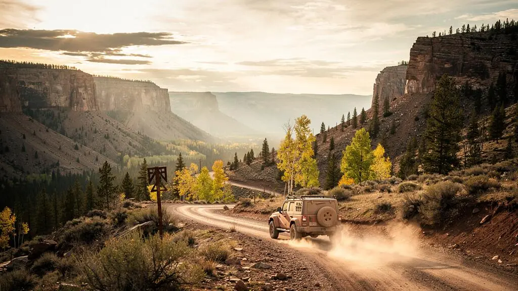
The allure of a remote backcountry trail is the promise of solitude and raw, unfiltered nature. But that same isolation, miles from mobile signal or recovery services, is what makes these adventures so unforgiving. Many aspiring adventurers believe that a modern 4×4 and a smartphone are all they need. They pack some water, fill the tank, and head for the hills, only to find themselves stuck, lost, or stranded when a single point of failure—a dead battery, a submerged trail, a simple puncture—cascades into a genuine emergency.
The common advice is to “bring a map” or “pack recovery gear,” but this barely scratches the surface. It’s not about just having the gear; it’s about understanding the scenarios where it will fail and having a backup for that failure. True wilderness readiness isn’t a checklist; it’s a strategic mindset. The key isn’t just preparing for the trail; it’s preparing for when your preparations fail.
This guide is built on that principle of self-reliance through systematic preparation. We will deconstruct the common points of failure and provide a framework for building robust, redundant systems for your vehicle and your skills. We will cover how to layer your navigation, what recovery gear is essential for getting unstuck *solo*, how to honestly assess a trail, and how to master the critical calculations that keep you moving. This is your blueprint for becoming self-sufficient in the backcountry.
This comprehensive guide is structured to build your self-reliance from the ground up. The following sections will equip you with the specialist knowledge needed to plan, execute, and safely return from your next unsupported wilderness adventure.
Summary: A Backcountry Specialist’s Guide to Tackling Remote Trails Without Service or Support
- Why Single-Device Navigation Fails 50% of Backcountry Trail Attempts
- How to Pack Recovery Boards, Tow Straps and Jacks That Get You Unstuck Solo
- Marked Backcountry Routes or Exploratory Trails: Which Match Your Vehicle and Skills
- The Fuel Calculation Mistake That Leaves 30% of Backcountry Drivers Stranded
- When Do Backcountry Trails Require Convoy Travel Rather Than Solo Attempts
- How to Set Up a Garmin InReach for Two-Way Messaging Without Any Mobile Signal
- What Ground Clearance Allows Safe UK Forest Track Access Without Damage Risk
- How to Drive Gravel and Dirt Tracks Confidently Without Four-Wheel Drive
Why Single-Device Navigation Fails 50% of Backcountry Trail Attempts
The single greatest point of failure on a remote trail is an over-reliance on a single navigation device. A smartphone or in-dash GPS feels infallible on paved roads, but in the backcountry, it’s a fragile thread. Batteries die, screens break, software glitches, and satellite signals drop in deep canyons or dense forests. As Backpacker Magazine notes, “Modern GPS navigation systems are excellent tools for finding your way, but, as with any device, they can fail.” This isn’t a hypothetical risk; data from the Adirondacks shows that a quarter of rescues stem from hikers missing a map or having a failed GPS.
The solution is not to abandon technology but to build a layered system of redundancy. This mindset accepts that any single tool *will* eventually fail and ensures a backup is ready. Your navigation toolkit should have at least three independent layers.
As the image above illustrates, this layered approach creates a robust safety net.
- Layer 1 (Primary): Your digital tool. A ruggedized tablet or dedicated off-road GPS unit with pre-downloaded offline maps (e.g., Gaia GPS, onX Offroad). This is your high-detail, everyday tool.
- Layer 2 (Analog Backup): A high-quality paper map of the region and a simple, reliable magnetic compass. This layer is immune to battery failure, impact damage, or software crashes. Critically, you must know how to use them together to take a bearing and locate your position.
- Layer 3 (Emergency Comms): A satellite messenger. This is not for primary navigation, but for confirming your location with a remote contact or calling for help if the first two layers fail catastrophically.
This system ensures that a single failure—even a major one—downgrades your convenience but never compromises your safety. It transforms a potential crisis into a manageable inconvenience.
How to Pack Recovery Boards, Tow Straps and Jacks That Get You Unstuck Solo
Getting stuck is not a matter of ‘if’ but ‘when’. In the backcountry, your recovery gear is your lifeline, and knowing how to use it alone is the ultimate test of self-reliance. The key is to think in terms of a graduated response—a sequence of tools and techniques you can deploy with escalating power. You don’t start with a winch for a minor loss of traction. Instead, you start with the simplest solution and work your way up. This conserves energy, reduces risk, and often solves the problem faster.
Your solo recovery kit should enable this graduated response:
- Assess and Clear: The first step is always to get out and look. Can you clear mud or rocks from in front of the tires with a shovel? Sometimes, 30 seconds of digging is all it takes.
- Airing Down & Traction Boards: Letting air out of your tires (to 15-20 PSI) increases the tire’s footprint and grip. If that’s not enough, recovery boards (like MAXTRAX) are your next step. They provide a high-traction surface to get you out of mud, sand, or snow. They are the single most effective and safest solo recovery tool for most situations.
- The High-Lift or Off-Road Jack: If a wheel is buried deep in a rut, a high-lift jack can be used to lift the vehicle and stack rocks or logs underneath the tire to provide a solid base. This is a dangerous tool and requires proper training and a stable base to avoid vehicle damage or serious injury.
- The Winch: This is the top of the solo recovery pyramid. A winch provides immense pulling power but requires a solid anchor point (a large tree with a tree-saver strap, a buried spare tire, or a purpose-built land anchor). Winching is a complex process involving high tension and specific safety protocols.
Case Study: Graduated Winch Recovery
A solo driver in a Jeep Wrangler found themselves in deep, sticky mud on an Oregon forest trail. As detailed in a recovery breakdown by off-road specialists, their initial attempt with traction boards failed as the mud was too deep and soupy. They escalated their response, deploying a winch. Critically, they didn’t just pull straight. They used a soft-shackle tree-saver strap to protect the anchor tree, and then a snatch block to redirect the pulling angle. This prevented dangerous sideways loading on the winch and allowed for a controlled, safe extraction, perfectly illustrating why a graduated toolkit and the knowledge to use it are more important than any single piece of gear.
Packing gear is easy; mastering its use under pressure is what brings you home. Practice with each tool in a safe, controlled environment before you need to rely on it in the wild.
Marked Backcountry Routes or Exploratory Trails: Which Match Your Vehicle and Skills
Choosing the right trail is the most critical decision you’ll make. It’s about honestly assessing the “resource delta”—the gap between what the trail demands and what your vehicle, your gear, and your skills can provide. A mismatch here is the root cause of most backcountry disasters. There’s no shame in tackling an ‘easy’ trail; the shame is in being airlifted off a ‘difficult’ one you weren’t prepared for. Trails are generally rated on a spectrum, and understanding this system is key to making smart choices.
The two main categories are marked routes and exploratory trails.
- Marked Backcountry Routes: These are often designated and maintained by land management agencies (like Forestry Service roads or Bureau of Land Management trails). They typically have a known difficulty rating, are shown on maps, and see at least occasional traffic. They are the ideal place to start and build experience.
- Exploratory Trails: These might be unmapped tracks, old mining roads, or routes you’ve plotted yourself via satellite imagery. They carry a much higher degree of uncertainty. Obstacles can be unpredictable, and the trail may become impassable without warning. These should only be attempted by highly experienced drivers with comprehensively prepared vehicles and a solid backup plan.
To make an informed choice, you must understand the common trail rating systems. While ratings can be subjective and vary by region, they generally follow a consistent pattern of escalating demands on the vehicle and driver. An analysis by onX Offroad provides a clear framework for what these ratings mean in practice.
| Difficulty Tier | Typical Obstacles | Vehicle Requirement |
|---|---|---|
| Easy | Graded dirt/gravel, obstacles under 5 inches, dry or shallow water crossings | Stock 2WD or 4WD, no special equipment |
| Moderate | Ruts, mud holes, ledges and grades up to 2 feet, water crossings up to 18 inches | Stock 4WD with good ground clearance and all-terrain tires |
| Difficult | Off-camber sections, loose rock, washes, obstacles up to 6 feet | Lifted 4WD, lockers, skid plates, experienced spotter recommended |
| Extreme | Deep holes, large rocks exceeding axle height, near-vertical grades | Heavily modified 4WD, winch, highly experienced driver only |
Always choose a trail rated at or, ideally, below your and your vehicle’s proven capability. Your first run on a ‘difficult’ rated trail should be with an experienced group, not alone. The goal is a successful adventure, not a survival story.
The Fuel Calculation Mistake That Leaves 30% of Backcountry Drivers Stranded
Running out of fuel is one of the most preventable yet common backcountry mistakes. The error is almost always the same: drivers calculate their needs based on their vehicle’s highway miles-per-gallon (MPG). This is a catastrophic miscalculation. In the backcountry, your fuel economy will plummet dramatically, and failing to account for this is what leaves people stranded. While the “30%” figure is illustrative of a widespread problem, the real-world penalty can be even higher.
The primary reason for this drop is the engagement of low-range 4WD. Driving slowly over technical terrain in 4-Low, with the engine revving high but the vehicle moving slowly, can cut your fuel economy by 50% or more. Other factors compound this effect:
- Increased Rolling Resistance: Soft surfaces like sand or mud require more energy to move through.
- Elevation Gain: Climbing steep grades puts a heavy load on the engine.
- Tire Pressure: Aired-down tires create a larger contact patch for grip but also increase rolling resistance on firmer sections.
- Idle Time: Time spent assessing obstacles, winching, or taking a break with the engine running for heat or AC still consumes fuel.
The only safe approach is a conservative, worst-case-scenario calculation. A reliable rule of thumb for backcountry fuel planning is the “Rule of Thirds” combined with a penalty factor.
- Calculate your baseline off-road consumption: Assume, at a minimum, that you will get half your highway MPG. If you get 20 MPG on the road, plan for 10 MPG off-road.
- Apply the Rule of Thirds: Plan to use one-third of your fuel for the trip out, one-third for the trip back, and always keep one-third in reserve for emergencies, getting lost, or unexpected detours.
- Carry a Surplus: Based on this calculation, determine how much extra fuel you need to carry in certified jerry cans. It’s always better to end the trip with too much fuel than to run out one mile short of the pavement.
Never assume you can just “find a gas station.” On a remote trail, the only fuel available is the fuel you bring with you.
When Do Backcountry Trails Require Convoy Travel Rather Than Solo Attempts
The decision to travel solo or in a convoy is a critical risk assessment. While solo travel offers ultimate freedom, it also carries the highest consequence; you are your only source of help. This is what we call the “isolation multiplier”—a simple mechanical issue becomes a trip-ending problem, and a moderate injury becomes a life-threatening crisis when you are completely alone. A convoy, on the other hand, provides immediate assistance, shared resources, and a vital safety net.
Certain conditions should automatically preclude a solo attempt for all but the most experienced and equipped individuals. These include:
- Extreme Trail Ratings: Any trail rated as ‘Difficult’ or ‘Extreme’ should not be attempted solo for the first time. The need for a spotter and potential for vehicle recovery is too high.
- Severe Weather Conditions: Impending snowstorms, flash flood warnings, or extreme heat add a significant and unpredictable layer of risk that is best managed with a group.
- Major River Crossings: A deep or fast-flowing water crossing is one of the highest-risk maneuvers. A stalled engine mid-river is a disaster solo but often a quick recovery with a second vehicle.
- Highly Unpredictable or Unmapped Terrain: If you are truly exploring, the risk of an impassable obstacle (like a washout or rockslide) is high. A second vehicle provides the option to backtrack safely.
As the team at Rough Country advises in their guide to solo overlanding, your own gut feeling is a crucial part of the toolkit: “Trust Your Gut: If something feels off, it probably is. Your instincts are your best guide.” Before any solo trip, an honest self-assessment is required.
Your Solo Trip Go/No-Go Checklist
- Vehicle & Personal Skills Audit: Do you have proven, first-hand experience with basic field repairs on your rig (e.g., changing a tire, fixing a hose)? Have you successfully used all your recovery gear alone in a practice setting?
- Route & Contingency Plan: Have you planned your primary route and identified at least two alternative exit routes (Plan B and Plan C)? Has this entire plan, including timelines, been shared with a reliable contact who is not on the trip?
- Systems Redundancy Check: Have you confirmed you have backups for all critical systems? This means a non-phone navigation system, extra fuel, a complete first aid kit, and all necessary recovery gear.
- Communication Link Established: Is your satellite communication device tested and active? Have you sent a test message from home to confirm it works before you lose signal? Isolation is the biggest risk multiplier.
- Final Instincts Check: Does any part of the plan feel rushed or beyond your comfort level? If there is any doubt, there is no doubt. Postpone, find a partner, or choose an easier route.
There is no trophy for attempting a solo trip you aren’t ready for. The real prize is returning home safely from a well-planned adventure, ready to plan the next one.
How to Set Up a Garmin InReach for Two-Way Messaging Without Any Mobile Signal
In the modern backcountry, a satellite communicator like the Garmin inReach is no longer a luxury; it is a fundamental piece of safety equipment. It provides a critical lifeline when you are far beyond the reach of mobile phone towers, enabling you to stay connected and call for help. However, simply buying one and throwing it in your pack is not enough. To be an effective tool, it requires proper setup and a bit of practice *before* you lose signal. Failure to do this “pre-trip” homework can render the device frustratingly complex or even useless in an emergency.
The core functions of an inReach device are two-way text messaging, location tracking, and, most importantly, triggering an SOS to a global emergency response coordination center. Getting the most out of these features requires a few simple steps to be completed at home. As a valuable article on the Garmin Support Center blog outlines, proper preparation is key.
Follow this checklist to ensure your device is fully operational before your wheels touch the dirt:
- Activate Your Subscription: An inReach device requires an active satellite subscription to function. Choose a plan that fits your trip frequency and activate it online via the Garmin Explore website. Do this at least 24 hours before your trip.
- Read the Quick Start Manual: Familiarize yourself with the basic button functions—power, up/down, OK, and the SOS button cover. Know how to navigate the core menus without a manual.
- Pair with Your Smartphone: Download the Garmin Explore app and pair your inReach with your smartphone via Bluetooth. This is a game-changer. It allows you to use your phone’s large keyboard to type messages, which is infinitely easier than selecting letters one by one on the device itself. It also syncs contacts, waypoints, and routes.
- Pre-Set Your Messages: You can create and save three preset messages on the Explore website (e.g., “Starting the trail now, all is well,” “Stopped for the night, everything is OK,” “Delayed but safe, continuing as planned.”). Sending these is free on many plans and is a quick way to keep your off-trail contact informed.
- Test Everything at Home: Go into your backyard with a clear view of the sky. Send a test message to a friend or family member to confirm two-way messaging works. Understand how to trigger (and cancel) an SOS. Knowing the process demystifies it and prevents accidental activation.
A satellite communicator is a powerful tool for mitigating the “isolation multiplier,” but only if you’ve invested the time to make it an integrated part of your workflow.
What Ground Clearance Allows Safe UK Forest Track Access Without Damage Risk
While this question specifically mentions UK forest tracks, the underlying principles of assessing ground clearance are universal for any driver tackling unpaved roads. Ground clearance is the minimum distance between the lowest point of your vehicle’s underbody (usually the differential, exhaust, or suspension components) and the ground. It determines the height of an obstacle you can drive over without causing expensive damage. Getting this assessment wrong can lead to getting hung up on a rock, tearing off a crucial component, or even puncturing your oil pan.
There is no single “safe” number, as it’s entirely relative to the trail you’re on. A stock SUV with 8 inches (approx. 200mm) of clearance may be perfectly safe on a graded gravel track but at extreme risk on a moderately rutted trail. The key is to know your vehicle’s specific clearance numbers and learn to “read” the trail ahead.
- Ground Clearance: The primary number. Found in your vehicle’s manual.
- Approach Angle: The maximum angle of a ramp you can drive up without the front bumper hitting.
- Departure Angle: The maximum angle of a ramp you can drive down without the rear bumper dragging.
- Breakover Angle: The maximum angle of a crest you can drive over without the middle of the vehicle getting stuck.
For most maintained forest tracks, often designated as ‘Easy’ or ‘Grade 1-2’, a standard 4×4 or AWD vehicle with stock ground clearance is generally sufficient. As RuffStuff Specialties notes, “Easy trails are usually gravel or dirt roads with mild obstacles that most stock 4WD vehicles can handle safely.” The problems arise when trail conditions degrade.
Before entering any track, use this mental checklist to assess the risk:
- Check for a Rating: If the trail has a posted difficulty, respect it.
- Read the First 100 Feet: The entrance to a trail is often a good indicator of its condition. Look at the depth of ruts and the size of rocks. Are they well below your vehicle’s lowest point?
- Walk the Line: If you encounter a questionable obstacle (a large rock, a deep rut, or a water crossing), get out of the vehicle and walk it. Your eyes are your best tool. Does it look like your differential will clear? Will your bumper hit on the approach?
- Remember Conditions Change: A trail rating is a snapshot in time. Rain can turn a simple dirt track into a series of deep, muddy ruts overnight. Never treat a rating as a guarantee.
Knowing your vehicle’s limits and having the humility to turn around are far more important than having an extra inch of lift.
Key takeaways
- Plan for Failure: The core of backcountry self-reliance is assuming every system—navigation, vehicle, communication—can and will fail. Your real plan is your backup plan.
- Adopt a Graduated Response: For recovery, start with the simplest solution (a shovel) and escalate methodically (traction boards, jack, winch). This saves energy and reduces risk.
- Know Your Resource Delta: The most important decision is choosing a trail. Honestly assess the gap between what the trail demands and what your vehicle and skills can deliver. When in doubt, choose the easier trail.
How to Drive Gravel and Dirt Tracks Confidently Without Four-Wheel Drive
While four-wheel drive is the gold standard for technical terrain, a surprising amount of backcountry can be explored confidently and safely in a two-wheel drive (2WD) vehicle with the right techniques and a healthy respect for its limits. Driving a 2WD off-pavement is a masterclass in momentum, line choice, and understanding traction. It forces you to be a smarter, more engaged driver.
The fundamental limitation of a 2WD vehicle is its open differential, which will send power to the wheel with the *least* traction. If one of your drive wheels is in the air or on a slippery surface like ice or wet mud, you’re not going anywhere. The entire art of 2WD off-roading is to avoid putting yourself in that situation. This is achieved through three core principles: momentum, line choice, and tire pressure.
Momentum is Your Best Friend: Unlike a 4WD that can often crawl slowly over obstacles, a 2WD vehicle needs to maintain steady momentum to get through tricky sections like soft sand or up a loose, gravelly hill. This does not mean excessive speed, which can lead to loss of control. It means approaching an obstacle with enough controlled velocity to carry you through to the other side where traction is better, without spinning your wheels.
Line Choice is Everything: As a 2WD driver, you must constantly be scanning the trail ahead, choosing the path of maximum traction.
- On a rutted road, try to keep your wheels on the high points (the ‘crowns’) rather than dropping into the ruts where you can get hung up.
- When approaching a rocky section, aim to put your tires on top of the flat parts of rocks rather than hitting them with your undercarriage.
- Avoid the muddiest, wettest-looking parts of the trail. Go around if possible.
Tire Pressure is Your Secret Weapon: Just as with a 4WD, airing down your tires is the single most effective modification you can make. Lowering pressure to around 20-25 PSI dramatically increases the tire’s footprint. This ‘floats’ the vehicle over soft surfaces like sand instead of digging in, and it allows the tire to conform around rocks and roots for better grip. Remember to carry a reliable portable air compressor to re-inflate your tires before returning to the pavement.
By mastering these principles of system redundancy, failure-planning, and honest self-assessment, you transform yourself from a passenger in a capable vehicle to its confident commander. Your journey to backcountry self-reliance begins not when you buy the gear, but when you master the mindset. Evaluate your current skills, pick a conservative first objective, and begin applying these strategies today.