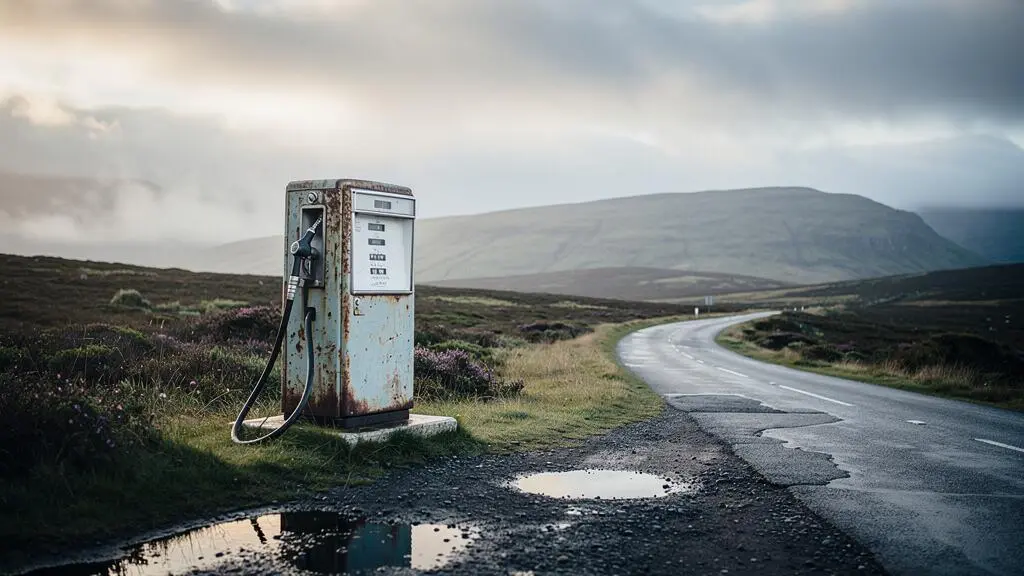
Relying solely on standard navigation apps for fuel in the UK’s remote areas is a recipe for disaster; they have critical data blind spots that can leave you stranded.
- Digital maps frequently miss small, independent fuel stations that are vital to the rural network.
- Fuel availability varies drastically, with Super Unleaded (E5) being especially rare, while diesel is common due to local agricultural demand.
- True fuel security requires a proactive, “analogue” approach: building a personal, verified map before you depart and adopting a strict “half-tank” refuelling rule.
Recommendation: Shift your mindset from passively searching for fuel to actively managing your fuel security as a core part of your journey planning.
The needle on the fuel gauge dips lower, the “miles to empty” countdown feels increasingly optimistic, and the endless, beautiful emptiness of the Scottish Highlands or Welsh mountains suddenly feels more menacing than magical. This is range anxiety, the quiet fear that every driver venturing into Britain’s wilder corners knows well. For many, the instinct is to pull over and trust the familiar comfort of Google Maps or Waze. The common advice is to “plan ahead” and “use an app,” but this digital-first approach is a dangerous platitude in regions where connectivity is a luxury, not a guarantee.
The reality on the ground is one of single-track roads, vanishing mobile signal, and fuel stations that operate on their own local rhythm. Standard digital tools, built for urban and suburban density, are simply not designed for this environment. They are prone to significant omissions and outdated information, creating a false sense of security that can be shattered dozens of miles from the nearest pump. The core issue isn’t just distance; it’s the unreliability of the data we’ve been conditioned to trust implicitly.
But what if the solution wasn’t a better app, but a better strategy? This guide moves beyond generic tips to offer a robust, map-based system for achieving true fuel security. We will deconstruct why your go-to apps fail and provide a clear framework for building your own reliable, offline fuelling map. We’ll explore which fuels are most dependable, debunk a common fuel gauge myth, and outline exactly when and how to safely carry extra fuel. It’s time to stop reacting to the fuel light and start navigating with the confidence of a seasoned remote-area strategist.
This article provides a comprehensive strategy for managing fuel in remote UK regions. The following sections will guide you through each critical step, from understanding the limitations of your apps to building a complete plan for staying connected and safe.
Summary: A Strategist’s Guide to Remote UK Fuelling
- Why Google Maps and Waze Miss 40% of Rural Fuel Stations in Remote Areas
- How to Download Offline Fuel Station Locations Before Entering Remote Zones
- Petrol or Diesel: Which Fuel Is More Reliably Available in Scotland’s Remote North
- The Fuel Gauge Mistake That Causes 1 in 8 Call-Outs in Remote Regions
- When Should You Carry a Jerry Can for Safety in Remote UK Regions
- How to Download Entire UK Regions for Offline Navigation in 3 Simple Steps
- What Remote UK Areas Justify Carrying Satellite Messengers for Safety
- How to Stay Connected and Navigate When Mobile Signal Disappears in Remote Areas
Why Google Maps and Waze Miss 40% of Rural Fuel Stations in Remote Areas
The fundamental flaw in relying on major navigation apps in the Highlands or rural Wales is that their data models are built for a world of franchises and digital footprints. These systems excel at tracking large, networked chains like Shell, BP, or supermarket stations, which consistently feed data into their databases. However, the fuel landscape in Britain’s remote areas operates on a completely different model. It is a network of small, fiercely independent filling stations, often attached to a village shop, post office, or local mechanic’s garage. These businesses are the lifeblood of their communities but often lack the digital presence to be automatically indexed by global tech companies.
As the Love Scotland travel guide editorial team notes, the on-the-ground reality is a complex mix of “single-track roads, vanishing mobile signal, and fuel stations that close at 5pm.” These factors create significant data blind spots. An app might show the “nearest” station as 20 miles away, failing to list a small, family-run pump just five miles down a side road because it’s not in its commercial database. This isn’t a rare occurrence; it’s a systemic issue.
A dedicated mapping project for the North Coast 500 route highlights this gap, finding it necessary to manually catalogue every stop. The project’s authors discovered that these vital, unlisted stations are what “keep remote communities connected.” Their analysis revealed that without this local knowledge, a driver might find that the nearest petrol station might be forty miles away on a road with no way to turn back or call for help. Trusting your app in this context isn’t just inconvenient; it’s a gamble with your safety.
How to Download Offline Fuel Station Locations Before Entering Remote Zones
The first rule of remote travel is to assume you will have zero connectivity. Simply “downloading the map” on your app is a good start, but it’s not enough. You need to proactively build a personal, verified fuel map—a process of analogue mapping that layers reliable information over a basic offline map before you lose signal. This process acknowledges that many crucial fuel sources are effectively invisible to digital-only searches.
As the image above suggests, the rural fuel economy includes sources that don’t appear on a standard database. The solution is to cross-reference multiple sources while you still have internet. Start with dedicated route guides and forums (like those for the NC500 or Snowdonia), where enthusiasts have already done the hard work of manually listing and verifying small stations. Mark these locations as “saved places” or “favourites” directly on your offline map app. As one seasoned traveller on a TripAdvisor forum bluntly states, “All the networks publish coverage maps – just a google should show what you’ve already been told – large areas of the Highlands have no coverage.”
This pre-trip intelligence gathering is your most powerful tool. One experienced NC500 motorhome driver advises a dual strategy: always treat every stop as a chance to top up, keeping your tank at least half full, and use interactive maps from blogs or forums rather than static screenshots, as they are often updated with closures or fuel type changes (like LPG availability). By layering this human-verified data onto your downloaded map, you transform it from a simple navigational aid into a strategic fuel security tool.
Petrol or Diesel: Which Fuel Is More Reliably Available in Scotland’s Remote North
Not all fuels are created equal in the remote corners of the UK. Your choice of vehicle—or at least your awareness of its fuel requirements—can have a significant impact on your journey. The key factor is local demand. Remote economies in areas like the Scottish Highlands are heavily reliant on agriculture, fishing, and forestry. This means that diesel is king. Farm machinery, fishing boats, and commercial vehicles almost universally run on diesel, ensuring a steady demand that keeps it available at nearly every rural pump, no matter how small.
Standard Unleaded (E10) petrol is also widely available, catering to the majority of passenger cars. However, if your vehicle requires high-performance Super Unleaded (E5), your planning must be far more meticulous. As the TBNI.Blog editorial team warns, finding E5 “things become a little more difficult – although certainly not impossible.” In reality, it’s exceptionally challenging. For example, a detailed guide confirms that on the entire 516-mile North Coast 500 route, Super Unleaded is only available at a handful of stations, primarily in the larger towns of Ullapool, Thurso, and Beauly. Missing one of these could mean a very long and anxious drive to the next.
The table below, based on data from route specialists, starkly illustrates this reliability gap. It highlights why understanding the local economic drivers is crucial for fuel planning.
| Fuel Type | Typical Availability in Remote North | Primary Local Demand Driver |
|---|---|---|
| Diesel | Widely available at almost every rural pump | Farm machinery, fishing boats, agricultural vehicles |
| Standard Unleaded (E10) | Widely available, but sometimes the only petrol option | General passenger vehicles |
| Super Unleaded (E5) | Very limited — only a handful of stations on the entire route | Classic/performance cars, low overall demand |
| HVO (Hydrotreated Vegetable Oil) | Rare, found mainly at some estates and commercial suppliers | Forward-looking estates and fleet operators |
Ultimately, while you can travel with any fuel type, drivers of diesel and standard petrol vehicles have a much larger margin for error. If you drive a performance car needing E5, your route isn’t just a line on a map; it’s a carefully planned chain of confirmed high-octane fuel stops.
The Fuel Gauge Mistake That Causes 1 in 8 Call-Outs in Remote Regions
The most common mistake drivers make is not misreading the fuel gauge itself, but misinterpreting what it represents. Your car’s “miles to empty” display is not a guarantee; it’s an estimate calculated based on recent driving conditions. On a flat motorway, it can be reasonably accurate. But in the relentless, winding, and steep gradients of the Highlands or Snowdonia, that estimate becomes dangerously deceptive. The constant climbing and descending dramatically increases fuel consumption, yet the dashboard’s algorithm may not adjust quickly enough, leading you to believe you have far more range than you actually do.
This is where infrastructure gaps become critical. Route analysis has found that the longest stretch between petrol stations on the NC500 is 46 miles. A 46-mile gap is manageable with an accurate gauge, but it’s a disaster waiting to happen if your car is burning fuel 30% faster than its estimate suggests. This is the “fuel gauge mistake”: trusting a number calculated for ideal conditions in a far-from-ideal environment. It’s a primary reason why drivers get caught out, even when they think they’ve planned ahead.
While official AA breakdown data shows that running out of fuel accounts for only about 1% of all ICE breakdown call-outs nationally, this statistic is misleading for remote travel. The *consequences* of that 1% event are exponentially higher in a Highland glen with no signal and no passing traffic for hours. The “1 in 8” figure often cited for remote areas reflects this heightened risk and consequence, where a simple miscalculation becomes a serious safety incident. The only reliable strategy is to ignore the estimate and obey a stricter, manual rule: the ‘Half-Tank’ Rule. The moment your gauge hits half, your primary objective becomes finding the next confirmed fuel stop on your personal map.
When Should You Carry a Jerry Can for Safety in Remote UK Regions
Carrying a jerry can is the ultimate safety net, an admission that even the best plans can fail. The decision to carry one isn’t about daily driving; it’s a strategic choice for specific scenarios. You should seriously consider it if your route includes known infrastructure gaps of over 40-50 miles, if you require a rare fuel type like Super Unleaded (E5), or if your journey involves extensive travel on single-track roads where turning back isn’t a simple option. As the NationalWorld motoring desk confirms, “Yes, it’s perfectly legal to fill up a jerry can or petrol can as long as it meets some basic standards.”
However, legality comes with strict rules for safe transport and storage. You cannot simply use any old container. The fuel must be stored in a can specifically designed and approved for flammable liquids. These are typically marked with a UN approval number, signifying they meet rigorous safety standards. The material of the can also dictates its maximum legal capacity for transport in a private vehicle. Getting this wrong not only poses a significant fire hazard but also violates transport regulations.
To ensure you’re acting safely and legally, it’s essential to follow a clear checklist. The following plan, based on UK regulations, outlines the critical points to verify before you transport any spare fuel.
Your Action Plan: Safely and Legally Transporting Fuel in a Jerry Can
- Check the container type and markings: Ensure you are using a UN-approved container. For transport in a private vehicle, the legal limits are metal cans up to 20 litres and plastic cans up to 10 litres. Never repurpose unmarked containers.
- Confirm total in-vehicle limits: Under CDG 2009 and ADR regulations, private individuals can transport a combined total of up to 60 litres of petrol per vehicle, provided it is correctly packaged in the approved containers mentioned above.
- Adhere to home storage caps: Be aware that separate rules apply for storage at home. You can legally store up to 30 litres of petrol on your private premises without needing to notify your local Petroleum Enforcement Authority (PEA).
- Ensure secure and upright storage: During transport, the can must be sealed tightly and secured in your vehicle (ideally in the boot) so that it cannot tip over or slide around. Store it away from direct sunlight and sources of heat.
- Fill and handle with care: Fill the can on a stable, flat surface, not inside the vehicle. Avoid filling it to the brim to allow for expansion. When pouring, use a proper funnel and do so in a well-ventilated area away from any ignition sources.
Ultimately, a jerry can is an expert-level tool. It provides peace of mind but demands respect and adherence to safety protocols. If you’re prepared to follow the rules, it can be the difference between a minor inconvenience and a major emergency.
How to Download Entire UK Regions for Offline Navigation in 3 Simple Steps
Preparing for a signal dead zone goes beyond simply finding fuel. Your navigation system is your lifeline for getting to that fuel stop, finding accommodation, or rerouting around an unexpected closure. As a campervan rental guide puts it, in the Highlands, “staying connected is no longer just a convenience — it is a safety net.” The process of downloading maps for offline use is simple but must be done correctly to be effective. The key is to download a large, comprehensive area, not just a narrow route corridor.
Here are the three essential steps to ensure your phone remains a powerful navigation tool, even with zero bars of signal:
- Define and Download a Wide Map Area: Before you leave home, open Google Maps or your preferred app. Instead of getting directions, use the “Offline maps” feature. Select “Select Your Own Map” and pinch/zoom to draw a large rectangle that covers your entire region of travel (e.g., the whole of the Scottish Highlands from Glasgow to Thurso). This ensures that if you need to make a significant detour, your map won’t run out. As travel blog The Mobile Homie succinctly advises, “Cell service vanishes in some valleys (download Google Maps ahead).”
- Download Satellite and Terrain Layers: A simple road map is good, but a terrain or satellite view is better. These layers give you crucial context about the landscape, helping you anticipate steep gradients, dense forests, or exposed moorland. Some apps allow you to download these layers for offline use. This visual information helps you make smarter decisions, especially if you have to navigate off your planned route.
- Ensure Power Redundancy: An offline map is useless on a dead battery. The second part of the “safety net” is power. Before you depart, ensure you have a reliable car charging cord and, ideally, a fully charged portable power bank. A long day of navigating with the screen on, especially in cold weather, can drain a battery surprisingly quickly. This simple preparation ensures your digital map—and all the personal waypoints you’ve saved—remains accessible all day.
By following these three steps, you are not just downloading a map; you are creating a resilient, self-contained navigation ecosystem that is independent of a mobile network.
What Remote UK Areas Justify Carrying Satellite Messengers for Safety
For most drivers, even on remote Highland roads, a well-planned trip with offline maps and a full tank is sufficient. However, there are levels of remoteness where the risk profile changes, and a satellite messenger becomes a justified piece of safety equipment. These devices, which operate independently of mobile networks, allow you to send pre-set “I’m OK” messages, custom texts, and most importantly, trigger an SOS alert with your exact GPS coordinates in a life-threatening emergency. The question is, when does the UK landscape become wild enough to warrant one?
The primary justification is a combination of zero mobile coverage and low traffic volume. This applies to vast areas in the Scottish Highlands away from the main tourist routes (like the NC500), such as the Fisherfield Forest (often called ‘The Great Wilderness’), the Knoydart peninsula, or deep within the Cairngorms National Park. Similarly, in Wales, the more remote parts of the Cambrian Mountains present similar challenges. If your itinerary involves hiking, cycling, or driving on estate tracks far from any A or B roads in these areas, you are a candidate for a satellite device.
Even with new technology aiming to improve coverage, significant gaps will remain. While a new satellite-to-phone service reportedly takes national landmass coverage from 89% to 95%, that remaining 5% is precisely where these wild areas lie. A satellite messenger is your personal insurance policy for that gap. It’s not for the convenience of checking emails; it’s for the critical moment when a mechanical failure, a fall on a hike, or a sudden medical issue occurs miles from any signal. It transforms a potentially fatal situation into a manageable emergency response.
The decision to carry one is a personal risk assessment. If your trip is confined to popular roads with regular passing traffic, it’s likely an unnecessary expense. But if your sense of adventure takes you beyond the reach of the mobile mast, it’s one of the wisest safety investments you can make.
Key Takeaways
- Never trust a single digital source for fuel; always build a personal, verified map by cross-referencing route guides and forums before you depart.
- Adopt the “Half-Tank Rule” as a non-negotiable principle: start looking for fuel the moment your gauge hits 50%, regardless of what the “miles to empty” display says.
- Understand the local fuel economy: Diesel is the most reliable fuel in remote agricultural areas, while Super Unleaded (E5) is extremely rare and requires meticulous planning.
How to Stay Connected and Navigate When Mobile Signal Disappears in Remote Areas
Achieving total self-sufficiency in remote areas is about building a holistic safety system that anticipates failure. Connectivity is more than just a phone signal; it’s your ability to navigate, check weather, and call for help. When the signal inevitably disappears, your preparation is all that stands between a smooth journey and a serious problem. As a Highlands travel guide for campervan users notes, with the UK’s 3G network switched off, coverage in remote areas will require a 4G or 5G-ready phone, making pre-planning even more critical.
The foundation of your system is navigation. As a forum contributor wisely advises, “If using your phone to navigate, set your journey whilst still connected to wifi and you shouldn’t have too many problems.” This simple act caches the route, but as we’ve established, it must be supplemented with a comprehensive offline map and your personally verified fuel stops. Power is the second pillar; a portable charger is not optional, it’s essential.
Beyond navigation, your safety system must account for the environment. The weather in the Highlands and Welsh mountains can change in an instant. Packing layers and full waterproofs is crucial, as is carrying basic supplies like water, snacks, and bug spray. Services and settlements “can be miles apart,” and a minor delay can quickly become a long wait. This physical preparation is just as important as your digital prep. It’s about creating a personal bubble of resilience, assuming that you are entirely on your own from the moment you leave a major town until you reach the next one.
With this strategic mindset, range anxiety fades away, replaced by the quiet confidence that comes from being truly prepared. You are no longer at the mercy of an unreliable app or a deceptive fuel gauge. Start building your personal fuel security plan today and transform your next journey into Britain’s wild landscapes into the adventure it’s meant to be.