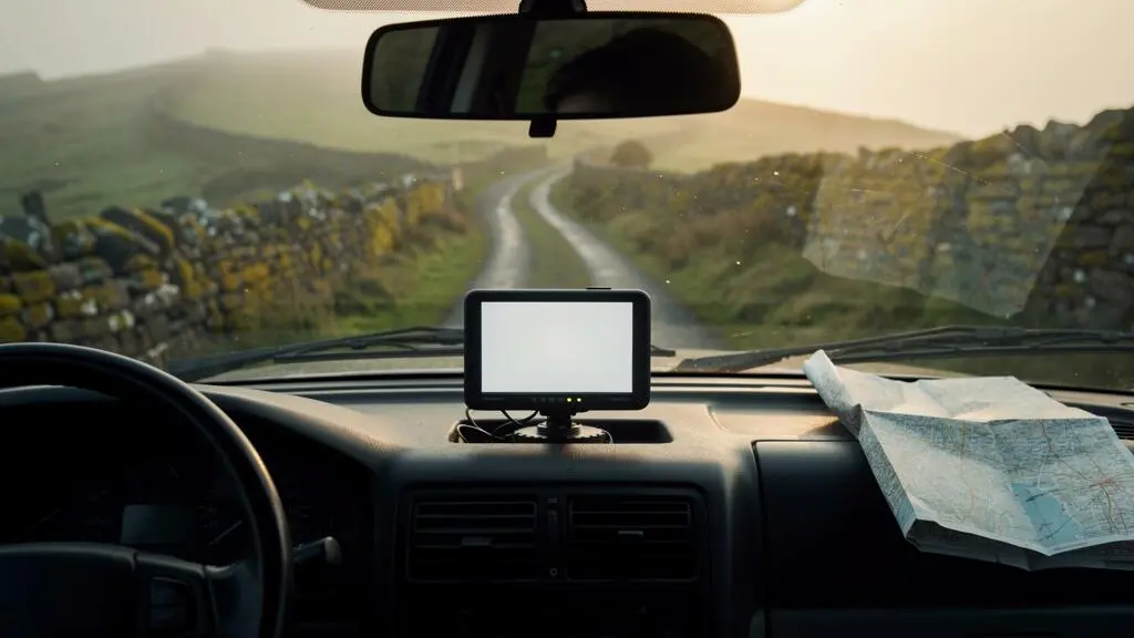
Relying on a standard phone app for rural navigation is a recipe for getting lost, as both the app and the phone’s hardware are fundamentally designed for connected, urban environments.
- A phone’s Assisted-GPS (A-GPS) often relies on cell towers for a fast, reliable fix, unlike a dedicated sat-nav’s independent multi-constellation GNSS receiver.
- Most map apps only cache a visual map layer, not the underlying routing data, meaning you can’t reroute or search for points of interest when you lose your data connection.
Recommendation: For true off-grid reliability, build a navigation redundancy system: use a dedicated sat-nav as your primary tool, a phone with true offline maps as a backup, and a traditional paper map as a final failsafe.
It’s a scenario familiar to any driver who has ventured beyond the motorway: the comforting voice of your navigation app falls silent, the screen freezes, and the map dissolves into a useless grey grid. Your phone shows you have GPS, a little blue dot mocking your position, but you have no route, no context, and no idea if the narrow track ahead is a shortcut or a dead end. This experience is especially common for tech-dependent drivers who trust their smartphone for everything, assuming that the “download offline maps” feature is a bulletproof solution for countryside trips.
The common advice to simply download a map region before you leave is dangerously simplistic. It overlooks the fundamental reasons why these systems fail. The problem isn’t just a lack of mobile signal; it’s a deeper technological mismatch. Your smartphone’s hardware and the apps it runs are optimised for the data-rich, densely mapped urban world. They are not inherently built for the ambiguity and disconnection of rural wayfinding. True navigation reliability in remote areas doesn’t come from hoping for a signal, but from adopting a connectivity-independent mindset and toolset.
This guide moves beyond the generic tips. We will dissect the technology, revealing why a dedicated sat-nav often outperforms a top-of-the-range smartphone in challenging terrain. We will compare the different systems, explain how to configure them to avoid common pitfalls like impassable farm tracks, and provide a practical framework to ensure you have a reliable navigation plan for any journey, no matter how far off the grid you go.
To help you navigate these crucial differences, this article breaks down the core components of reliable off-grid navigation. The following sections will guide you through the technical distinctions, practical setup steps, and strategic choices needed to stay on course.
Summary: How to Choose a Sat-Nav That Works in Rural Areas Without Mobile Signal
- Why Google Maps Stops Working the Moment You Leave A-Roads in Rural Wales
- How to Download Entire UK Regions for Offline Navigation in 3 Simple Steps
- Dedicated Sat-Nav or Phone App: Which Navigates Remote Routes More Reliably
- The Outdated Map Mistake That Routes 40% of Drivers Onto Impassable Tracks
- How to Configure Your Sat-Nav to Avoid Single-Track Roads and Water Crossings
- Why Google Maps and Waze Miss 40% of Rural Fuel Stations in Remote Areas
- Why Your Phone Shows Your Location But Won’t Load the Map in Signal-Free Zones
- How to Stay Connected and Navigate When Mobile Signal Disappears in Remote Areas
Why Google Maps Stops Working the Moment You Leave A-Roads in Rural Wales
The primary reason popular mapping apps like Google Maps or Waze become unreliable in rural areas is their fundamental dependence on crowd-sourced, user-generated data. These platforms are brilliant in cities because millions of users are constantly feeding them real-time information. In sparsely populated regions, this data stream dries up, revealing significant gaps and inaccuracies in the base map. This phenomenon is known as geographic bias, where data quality is directly proportional to population density.
As the California Learning Resource Network notes in its analysis of map accuracy, this bias creates major disparities between urban and rural coverage. The platform explains the core issue:
Geographic Bias: User contributions tend to be concentrated in densely populated areas, leading to disparities in data quality between urban and rural regions.
– California Learning Resource Network, Why is Google Maps Not Accurate?
This isn’t just a theoretical problem; it has a massive real-world impact on travel time and route viability. An algorithm that assumes a B-road has the same characteristics as one in a home county can lead you disastrously astray. Research comparing mapping data with on-the-ground reality found that while travel time estimates were off by a few minutes in cities, the gap widened dramatically in the countryside. The study revealed that in remote areas, there were average discrepancies of up to 90 minutes. This proves that once you leave the well-trodden A-roads, the routing engine’s ability to predict your journey falls apart.
How to Download Entire UK Regions for Offline Navigation in 3 Simple Steps
The first line of defence against signal loss is downloading maps for offline use. However, this is more than a one-click process. Success depends on understanding file sizes, storage management, and verification. A common shock for first-time users is the sheer amount of data required. For instance, downloading a detailed Ordnance Survey map for a single UK National Park can be a significant commitment; one National Parks download package can run to 15 GB or more. Preparing your device is therefore a critical first step.
The process can be broken down into three key stages: specifying your area, managing the download, and verifying its offline functionality. First, be as precise as possible. Instead of downloading an entire county, zoom in on your specific route and destination to select a smaller, more manageable map section. Second, ensure the map data is being saved to your device’s internal storage, not a cloud-linked folder, which would defeat the purpose of offline access. Finally, always test the map before you leave by putting your phone in airplane mode and trying to search for a location or plan a route within the downloaded area.
Many users encounter errors like “area is too big” or find that their subscription doesn’t cover the required download volume. Overcoming these common hurdles is essential for building a reliable offline map library.
Action Plan: Fixing Failed or Oversized Offline Map Downloads
- Focus the Area: Zoom in on the map to focus on the specific area you actually need, then download that smaller section rather than an entire region at once.
- Use Custom Boundaries: Use a dedicated ‘Download Area’ tool where available to draw a custom boundary so only the necessary region is stored.
- Check Storage Location: Check that offline maps are saving to the device’s local storage rather than being redirected to the cloud, which would defeat the purpose offline.
- Confirm Subscription Tier: Confirm the subscription or account tier allows the volume of offline data being requested before relying on it in the field.
Dedicated Sat-Nav or Phone App: Which Navigates Remote Routes More Reliably
The central debate for rural drivers is whether a smartphone is “good enough” or if a dedicated sat-nav is a worthwhile investment. The answer lies in the hardware. A smartphone is a jack-of-all-trades, with its internal components, including its GPS antenna, competing for space and power. A dedicated sat-nav is a master of one: its entire design is optimised for positioning and navigation. This distinction is most apparent in the technology they use to find your location.
Smartphones typically use Assisted-GPS (A-GPS), which leverages mobile tower data for a faster initial position lock. When you lose signal, the “assisted” part disappears, and the phone’s small, multi-purpose antenna struggles. A dedicated device uses a larger, more powerful GNSS (Global Navigation Satellite System) receiver that can track multiple satellite constellations (GPS, GLONASS, Galileo) simultaneously, making it far more robust in valleys, forests, or anywhere with a limited view of the sky.
This technical superiority translates into real-world reliability. The difference in signal reception, antenna design, and primary function creates a clear performance gap in challenging terrain, as highlighted by GPS industry analysis.
| Aspect | Dedicated Sat-Nav (GNSS receiver) | Smartphone (A-GPS) |
|---|---|---|
| Signal reliance | Independent multi-constellation reception, not dependent on cell towers | Often assisted by cell towers for a faster initial fix |
| Antenna design | Larger, dedicated GNSS antenna | Compact antenna shared among multiple radios |
| Reception in valleys/forests | Substantially more reliable satellite reception | More prone to signal degradation and loss |
| Primary role of the device | Mostly dedicated to the positioning and navigation mission | One of many competing functions crammed into the device |
However, the best strategy isn’t always a case of “either/or”. Many experienced backcountry travellers adopt a two-tiered system. As one field test of navigation gear noted, a common practice is to use a dedicated device for core tasks while relying on a smartphone app as a secondary layer, illustrating a “primary/backup” pairing. This navigation redundancy is the gold standard for safety and reliability.
The Outdated Map Mistake That Routes 40% of Drivers Onto Impassable Tracks
Even with a perfect GPS signal, your navigation is only as good as its map. A common and dangerous mistake is assuming that a map on a screen is an accurate reflection of the ground today. In rural areas, the “vintage” of commercial map data can diverge significantly from official records and current conditions. Roads are reclassified, tracks fall into disrepair, and private land access changes, but these updates can take years to filter through to commercial mapping products.
This is the gap that strands drivers on routes that are no longer passable. As one analysis comparing commercial and government maps explains, commercial data may not align with official records in remote locations. This discrepancy between the digital map and the physical world is precisely what leads a sat-nav to confidently direct a family car onto a boggy farm track.
Furthermore, even when a road is correctly mapped, the data about its characteristics is often missing. The routing algorithm needs more than just a line on a map; it needs to know the road’s surface, width, and typical speed to make an intelligent choice. Many open-source maps lack this crucial context.
Readily available data sources like OpenStreetMap (OSM) often lack information about the average speed of a road, though OSM contains other road information which enables an estimation of average speed in rural regions.
– Study authors, Fuzzy Framework for Speed Estimation research
When a routing engine lacks reliable speed data, it often defaults to the shortest path, which in the countryside is frequently a narrow, slow, or unsuitable single-track lane. This is why a seemingly “efficient” route can turn into a stressful, hour-long crawl.
How to Configure Your Sat-Nav to Avoid Single-Track Roads and Water Crossings
The default “fastest route” setting on most navigation devices is your enemy in the countryside. These algorithms are optimised for efficiency and will often choose a narrow, winding single-track lane if it shaves a few minutes off the ETA. To navigate rural areas safely and without stress, you must proactively build a custom routing profile that tells the device what to avoid.
Start by digging into the settings menu. Look for options beyond a simple “avoid motorways” toggle. Many advanced sat-navs and apps allow you to express a preference against unpaved roads, ferries, or narrow streets. For larger vehicles like campervans or those towing caravans, it’s essential to select a dedicated vehicle mode or even input your vehicle’s specific dimensions (height, width, weight). This allows the routing engine to automatically exclude roads with low bridges or weight limits.
The most effective strategy involves manually overriding the algorithm’s choices. Before setting off, review the proposed route. If it suggests a questionable shortcut down an unclassified road, you can force a better path by adding an intermediate “via” point on a known, major A- or B-road. This pins the route to your preferred path. For ultimate peace of mind, cross-referencing the digital route with a topographic map layer can reveal steep gradients or fords that the sat-nav’s data might miss.
- Select a dedicated vehicle mode (e.g., car, truck) rather than a generic profile.
- Input your vehicle’s height, width, and weight if the app supports it.
- Increase the sensitivity to avoid unpaved or single-track classifications.
- Cross-check the route against a topographic map layer to spot hazards like steep contours.
- Add manual “via” points on known major roads to force the algorithm to stick to them.
Why Google Maps and Waze Miss 40% of Rural Fuel Stations in Remote Areas
Just as road data is sparse in rural areas, so is information on Points of Interest (POIs) like fuel stations, shops, and cafes. The major map providers are slow to add or verify small, independent businesses in remote locations. This means your app might show the nearest petrol station is 50 miles away, when in fact there’s a local, unbranded one just around the corner. Conversely, it might confidently show a fuel stop that closed down two years ago.
This unreliability of POI data offline is a critical planning failure. Many drivers assume that because they can see a fuel pump icon on the map, they’ll be able to search for it and route to it without a signal. This is often not the case. The icon may be part of a cached visual layer, but the underlying searchable data is not included in the standard offline map download. One user on a mapping community forum voiced this common frustration with data accuracy:
In many cases, roads are represented as straight lines on actual curves, positioned inaccurately away from their real location…
– Local Guides Connect community member, Concerns Regarding Road Mapping Accuracy on Google Maps
To combat this, you must plan your critical stops proactively. Before losing signal, establish your vehicle’s “point of no return” by calculating your remaining range against the distance to the next confirmed fuel point. Don’t rely on generic offline searches for “petrol”; instead, note the exact names or coordinates of known stations. Using community-vetted apps like Park4Night or The Outbound as a cross-referencing layer can help identify independent businesses that commercial maps miss.
Why Your Phone Shows Your Location But Won’t Load the Map in Signal-Free Zones
This is perhaps the most confusing and frustrating failure for smartphone navigators: you can see the blue dot of your location moving accurately across a blank screen. This happens because your phone’s navigation function is split into two separate parts: the GPS chip (which finds your location) and the map app (which displays the map and calculates the route). These two components have very different connectivity needs.
As The Droid Guy’s editorial team clearly explains, the core of the issue is data dependency:
Your phone’s GPS chip works without an internet connection, but most navigation apps need data to load map tiles, calculate routes, and display points of interest.
– The Droid Guy editorial team, 7 Best Offline GPS Map Apps for Android in 2026
The GPS chip is a passive receiver; it simply listens for signals from satellites orbiting the Earth to determine your coordinates. This process requires no mobile data. The map app, however, needs to download the visual “tiles” that make up the map, along with traffic data, POIs, and routing information. When you have no signal, the GPS chip continues to work perfectly, moving your blue dot, but the app has no way to fetch the map data to display underneath it. This is the difference between a simple cached view and a true, fully-featured offline map.
Ironically, the underlying GPS hardware in phones is constantly improving. But these enhancements don’t solve the core data problem. A faster location fix is useless if the app can’t draw the map around it.
Key Takeaways
- Standard phone apps fail in rural areas due to a reliance on cell tower assistance (A-GPS) and crowd-sourced data that is sparse outside of cities.
- Dedicated sat-navs use more powerful, independent GNSS receivers and larger antennas, providing a more reliable satellite lock in challenging terrain like valleys and forests.
- The ultimate solution is a navigation redundancy system: a primary dedicated device, a phone with true offline maps as a backup, and a paper map and compass as a non-electronic failsafe.
How to Stay Connected and Navigate When Mobile Signal Disappears in Remote Areas
The ultimate strategy for reliable rural navigation is not to rely on a single device, but to build a layered navigation redundancy system. This approach acknowledges that any single piece of technology can fail and ensures you always have a backup. A robust system consists of at least three tiers: a primary electronic navigator, a secondary electronic backup, and a final analog failsafe.
Your primary navigator should be the most reliable tool for the job: a dedicated sat-nav with fully downloaded, up-to-date maps. Your secondary backup should be your smartphone, but loaded with a different offline mapping app (e.g., Gaia GPS, OS Maps) from your primary. This prevents a single point of data failure (like a corrupted map file) from taking out both your systems. The final, non-negotiable tier is a physical paper map of the area and a simple compass. This requires no batteries and is immune to all forms of technical failure.
For true off-grid peace of mind, especially in areas with no prospect of signal for days, consider adding a satellite messenger to your kit. Devices from brands like Garmin or Zoleo operate independently of cell towers, using satellite constellations to send and receive text messages, transmit your location, and trigger an SOS alert in a genuine emergency. With modern power-saving modes, a satellite messenger’s battery life is exceptionally long; a single charge can last up to 600 hours. This device is not primarily for navigation, but for communication—closing the final gap in your safety net.
Before your next rural adventure, take the time to audit your current navigation tools and build the multi-layered redundancy system outlined here. It’s the most critical preparation you can do to ensure a safe and stress-free journey.